Road Markings
Network-wide road marking visibility insights powered by connected vehicle data.
Make your roads visible with complete and continuous scans of your road markings
Road markings are critical infrastructure for drivers, advanced driver-assistance systems, and autonomous vehicles. But their visibility changes continuously due to wear, traffic, dirt, weather and seasonal conditions.
NIRA Road Markings continuously measures how visible road markings actually are in real driving conditions using connected vehicle data. The result is a network-wide understanding of where markings are visible, fading, worn down, or missing — helping road operators make better maintenance decisions while supporting safer and more reliable mobility.


Missing road markings
Identify where markings are no longer present.

Worn-down markings
Detect accelerated degradation over time.

Reduced visibility
Measure visibility in real driving conditions.
Why road marking visibility matters
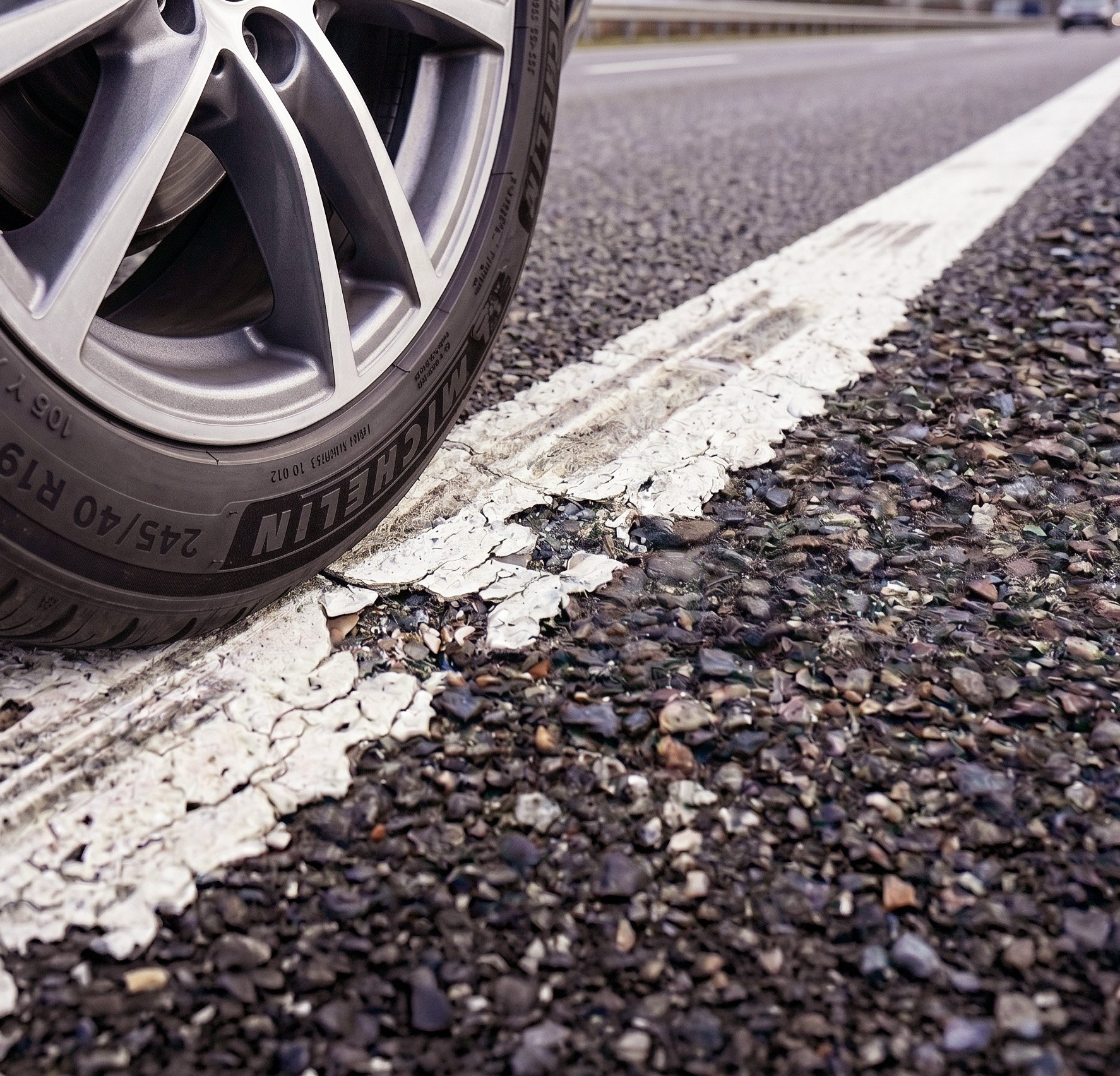
Road markings guide drivers, support road safety, and help ADAS and automated vehicles interpret the road ahead. But visibility changes, making reliable road markings increasingly important for both human drivers and vehicle systems.
Traditional road marking surveys rely on visual inspections and retroreflectivity measurements to assess marking condition and performance. While retroreflectivity is a widely accepted indicator of nighttime visibility, collecting measurements across an entire road network is costly and time-consuming, often requiring surveys to be conducted over extended periods. During this time, environmental factors such as dirt accumulation, rainfall, moisture, and seasonal conditions can vary substantially across the network and influence the measured values. Consequently, differences in retroreflectivity may not solely reflect the underlying condition of the road markings but also temporary surface conditions at the time of measurement, making it difficult to obtain a consistent, comparable, and up-to-date network-wide assessment of marking visibility.
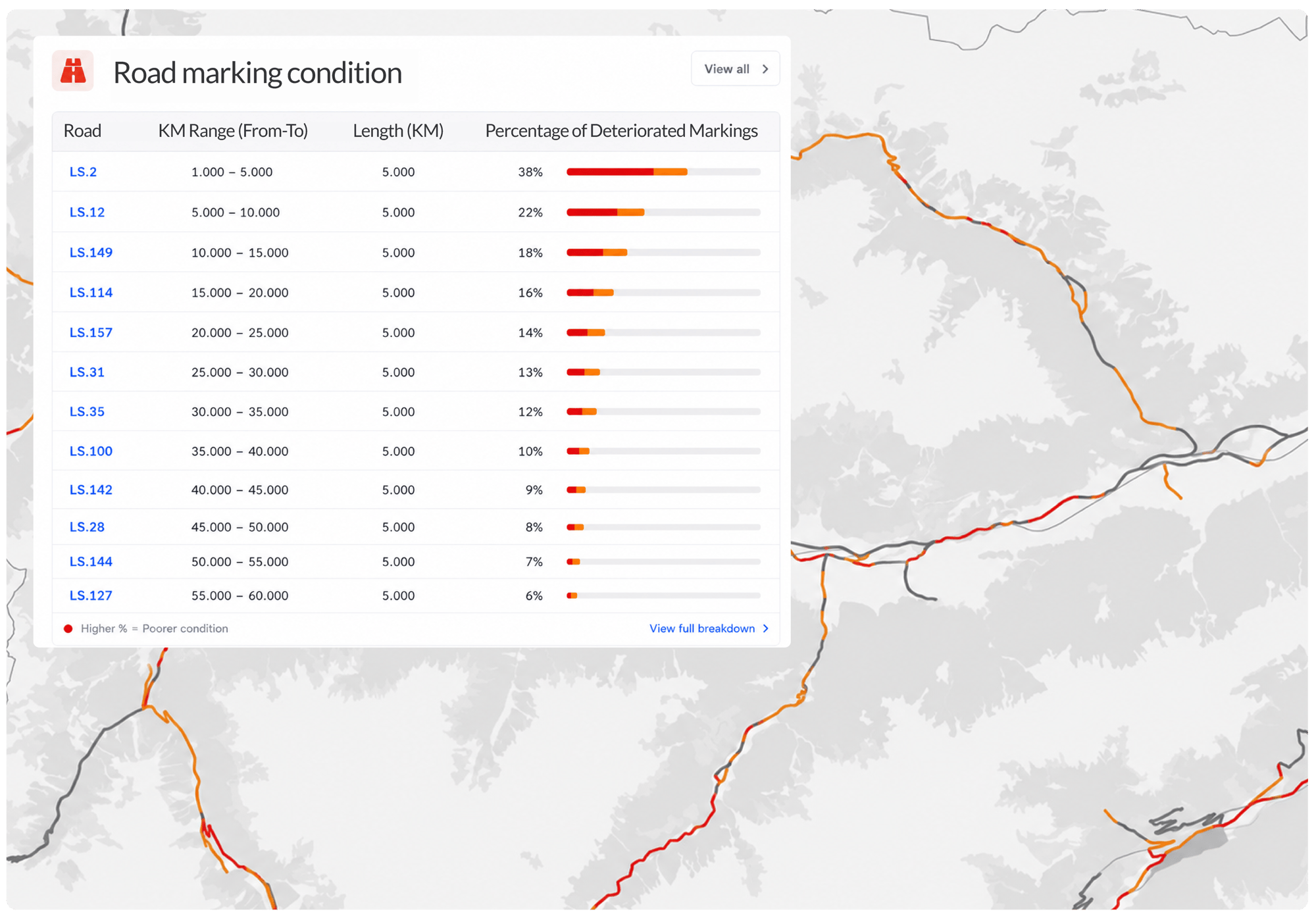
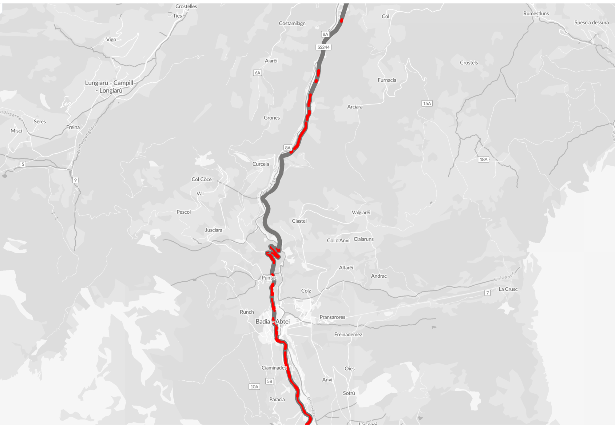
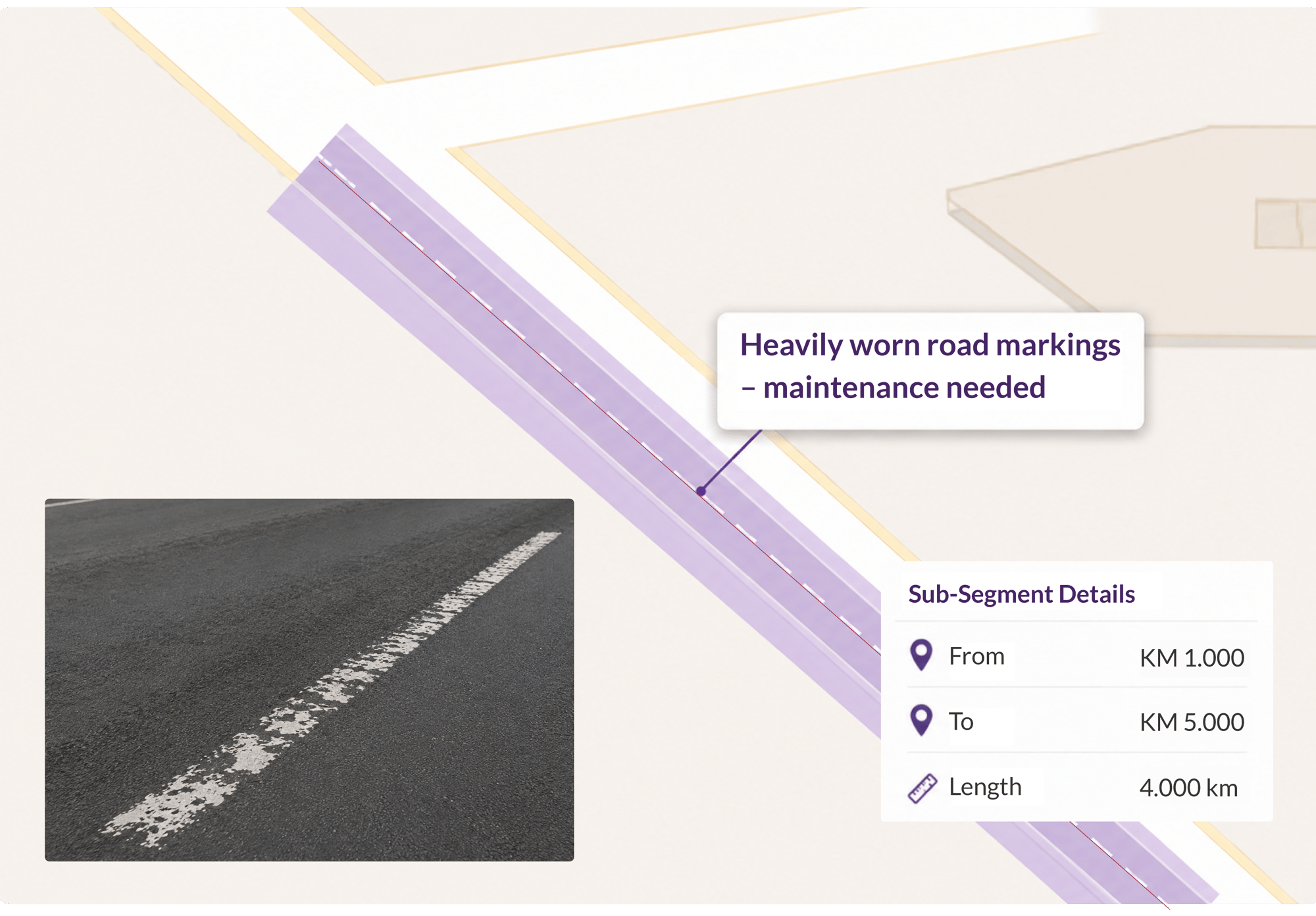
NIRA measures road marking visibility as experienced by vehicles on the road—continuously and under real driving conditions. NIRA dynamics car fleet provides visibility observations at each vehicle pass. This enables a realistic, up-to-date view of marking performance across the network, capturing not only current visibility but also how it changes over time. These trends make it possible to estimate deterioration rates and support more informed maintenance and asset management decisions.
Who benefits from NIRA Road Markings?
Road authorities: Enable more efficient management of road marking maintenance through continuous visibility insights for planning, procurement, inspection, and operational follow-up.
Contractors: Identify where markings are worn, fading, or missing and follow how visibility develops over time. NIRA Road Markings data supports more efficient inspections, targeted repainting, and objective follow-up of maintenance results.
Key capabilities of Road Markings by NIRA
NIRA continuously measures road marking visibility across the road network using connected vehicle data from everyday traffic.

- Detect worn, fading, and missing markings: Identify missing and heavily worn road markings, reduced visibility, and areas where markings degrade faster than expected.
- Understand change over time: Track both current status and historical development month by month to understand how visibility changes across seasons, weather conditions, traffic intensity, and road usage.
- High-resolution road insights: Visibility is measured with 25-meter resolution, enabling detailed and actionable insights across the road network.
- Broad road marking coverage: Analyze lane markings, center and edge lines, arrows, symbols, and other painted road features.
Multi-level road marking insights: From network overview to 25-meter segments
NIRA Road Markings provides visibility insights across three levels of detail — from network-wide overview to individual road segments.

Operating area level: Get a complete overview of road marking visibility across your entire operating area and identify where deterioration occurs over time.

Road level: Analyze visibility and deterioration for individual roads, including affected road length and historical development over time.

Sub-segment level: Zoom into detailed 25-meter segments with lane position insights to identify exactly where visibility is reduced, markings are worn, or lines are missing.
Use cases: Where NIRA Road Markings makes a difference
✅ Identify unexpected wear patterns
Detect roads where markings deteriorate faster than expected due to traffic intensity, road design, or environmental conditions.
✅ Prioritize projects
Identify which road sections need repainting first based on actual visibility conditions instead of fixed maintenance intervals.
✅ Reduce field inspections
Use network-wide visibility insights to focus on the roads most likely to require on-site inspection or intervention.
What does the data contain?
NIRA Road Markings delivers structured, actionable data streams designed for seamless integration into your existing GIS or maintenance management systems. Key data points include:
-
Visibility score: An objective metric of how visible the marking is under current conditions.
-
Degradation rate: Tracks how rapidly the marking is wearing down.
-
Traffic volume context: Marking wear and traffic volume trends.
-
Precise geolocation: Accurate mapping down to 25-meter segments.
-
Historical trends: Time-series data extending months back to analyze seasonal and long-term changes.
What makes NIRA Road Markings data unique?
Data Enhancer: Camera-based vehicle data is often noisy and difficult to interpret. NIRA has developed advanced algorithms that process the data, making it understandable, reliable, and easy to use in customer applications.
Large-scale connected network: We leverage data from millions of connected vehicles, including fleets from major partners like the Volkswagen Group, ensuring unparalleled broad coverage and continuous updates.
Real-world visibility, not lab conditions: NIRA measures markings as vehicles experience them in traffic. Dirty, obscured, or seasonally degraded lines are captured as they truly are, not as they appear after a pre-inspection clean.